History and Development of Cubbington
The placename ‘Cubbington’ is first mentioned in the Domesday Book of 1086, where it appears as Cobintone and Cubintone. The name means ‘the town or settlement of Cubba’s people

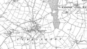
Cubbington 1886

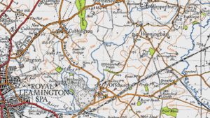
Figure 1948 map and the earliest signs of New Cubbington
Incremental development and growth took place from the 1800s up to the early 20th century then there was significant residential development from the 1950s onwards when development of New Cubbington commenced. The most recent developments along the Rugby Road have expanded the village footprint
The number of buildings and structures that are listed as being of historical interest or importance provides evidence of the development of the neighbourhood area over the centuries. There are 17 in total distributed throughout the neighbourhood area. They include a wide variety of structures from St Mary’s church to Offchurch Bridge.

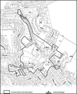
Cubbington Conservation Area and Listed Buildings
Listed Buildings are within and clustered around Cubbington village. A significant number of these structures help to define the boundary The Conservation Area in Cubbington was designated in 1969 and extended in 2001.The current boundary of the Conservation Area is also shown on the map. This represents the historic core of Cubbington village and is an incredibly important environmental and social characteristic to be protected and enhanced for the future.